Saint-Cyr-du-Bailleul
Gemeente in Frankrijk  | |||
|---|---|---|---|
  | |||
| Situering | |||
| Regio | Normandië | ||
| Departement | Manche (50) | ||
| Arrondissement | Avranches | ||
| Kanton | Le Mortainais | ||
| Coördinaten | 48° 34′ NB, 0° 48′ WL | ||
| Algemeen | |||
| Oppervlakte | 23,41 km² | ||
| Inwoners (1 januari 2021) | 352[1] (15 inw./km²) | ||
| Hoogte | 92 - 226 m | ||
| Overig | |||
| Postcode | 50720 | ||
| INSEE-code | 50462 | ||
| Detailkaart | |||
 | |||
| Foto's | |||
 | |||
| Église Saint-Cyr-et-Sainte-Juliette | |||
| |||

Saint-Cyr-du-Bailleul is een gemeente in het Franse departement Manche (regio Normandië) en telt 427 inwoners (2005). De plaats maakt deel uit van het arrondissement Avranches.
Geografie
De oppervlakte van Saint-Cyr-du-Bailleul bedraagt 23,3 km², de bevolkingsdichtheid is 18,3 inwoners per km².
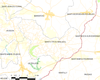
De onderstaande kaart toont de ligging van Saint-Cyr-du-Bailleul met de belangrijkste infrastructuur en aangrenzende gemeenten.
 |
Demografie
Onderstaande figuur toont het verloop van het inwonertal (bron: INSEE-tellingen).

Mediabestanden
Zie de categorie Saint-Cyr-du-Bailleul van Wikimedia Commons voor mediabestanden over dit onderwerp.
- ↑ Populations légales 2021.


