Department in Sassandra-Marahoué, Ivory Coast
Sinfra Department Département de Sinfra |
|---|
|
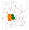
 Location in Ivory Coast. Sinfra Department has retained the same boundaries since its creation in 1988. |
| Country |  Ivory Coast Ivory Coast |
|---|
| District | Sassandra-Marahoué |
|---|
| Region | Marahoué |
|---|
| 1988 | Established as a first-level subdivision via a division of Bouaflé Dept |
|---|
| 1997 | Converted to a second-level subdivision |
|---|
| 2011 | Converted to a third-level subdivision |
|---|
| Departmental seat | Sinfra |
|---|
| Government |
|---|
| • Prefect | Konian Niasson |
|---|
| Area |
|---|
| • Total | 1,700 km2 (700 sq mi) |
|---|
| Population |
|---|
| • Total | 245,226 |
|---|
| • Density | 140/km2 (370/sq mi) |
|---|
| Time zone | UTC+0 (GMT) |
|---|
Sinfra Department is a department of Marahoué Region in Sassandra-Marahoué District, Ivory Coast. In 2021, its population was 245,226 and its seat is the settlement of Sinfra. The sub-prefectures of the department are Bazré, Kononfla, Kouétinfla, and Sinfra.
History
Sinfra Department was created in 1988 as a first-level subdivision via a split-off from Bouaflé Department.[4]
In 1997, regions were introduced as new first-level subdivisions of Ivory Coast; as a result, all departments were converted into second-level subdivisions. Sinfra Department was included in Marahoué Region.
In 2011, districts were introduced as new first-level subdivisions of Ivory Coast. At the same time, regions were reorganised and became second-level subdivisions and all departments were converted into third-level subdivisions. At this time, Sinfra Department remained part of the retained Marahoué Region in the new Sassandra-Marahoué District.
Notes
- ^ "Préfets de Région et de Préfets de Département (Conseil des ministres du mercredi 26 septembre 2012)", abidjan.net, 2 October 2012.
- ^ "Découverte de la Marahoué", ardci-rd.org, accessed 23 February 2016.
- ^ Citypopulation.de
- ^ "Regions of Côte d'Ivoire (Ivory Coast)", statoids.com, accessed 16 February 2016.
6°51′N 5°55′W / 6.850°N 5.917°W / 6.850; -5.917

 Ivory Coast