National Register of Historic Places listings in Putnam County, Indiana

This is a list of the National Register of Historic Places listings in Putnam County, Indiana.
This is intended to be a complete list of the properties and districts on the National Register of Historic Places in Putnam County, Indiana, United States. Latitude and longitude coordinates are provided for many National Register properties and districts; these locations may be seen together in a map.[1]
There are 34 properties and districts listed on the National Register in the county. Another property was once listed but has been removed.
Properties and districts located in incorporated areas display the name of the municipality, while properties and districts in unincorporated areas display the name of their civil township. Properties and districts split between multiple jurisdictions display the names of all jurisdictions.
This National Park Service list is complete through NPS recent listings posted May 31, 2024.[2]
Map all coordinates using OpenStreetMap
Download coordinates as:
- KML
- GPX (all coordinates)
- GPX (primary coordinates)
- GPX (secondary coordinates)
Current listings
| [3] | Name on the Register[4] | Image | Date listed[5] | Location | City or town | Description |
|---|---|---|---|---|---|---|
| 1 | Bainbridge Historic District | Upload image | March 14, 2019 (#100003506) | Generally E. side of Washington St. from 123 S. to 405 N. & Main St. from 312 W. to 421 E. 39°45′41″N 86°48′43″W / 39.7613°N 86.8119°W / 39.7613; -86.8119 (Bainbridge Historic District) | Bainbridge | |
| 2 | Baker's Camp Covered Bridge |  | May 21, 2024 (#100010368) | County Road 650 North over Big Walnut Creek. 39°44′57″N 86°46′31″W / 39.7491°N 86.7752°W / 39.7491; -86.7752 (Baker's Camp Covered Bridge) | Bainbridge | |
| 3 | The Boulders |  | September 16, 1993 (#93000948) | 835 E. Washington St. 39°38′39″N 86°50′46″W / 39.6442°N 86.8461°W / 39.6442; -86.8461 (The Boulders) | Greencastle | |
| 4 | Brick Chapel United Methodist Church |  | September 28, 2003 (#03000973) | 3547 N. U.S. Route 231 at Brick Chapel 39°42′43″N 86°52′07″W / 39.7119°N 86.8686°W / 39.7119; -86.8686 (Brick Chapel United Methodist Church) | Monroe Township | |
| 5 | Samuel Brown House |  | June 21, 2006 (#06000520) | 1558 E. County Road 1100N, southwest of Roachdale 39°49′N 86°49′W / 39.82°N 86.82°W / 39.82; -86.82 (Samuel Brown House) | Franklin Township | |
| 6 | Cloverdale Historic District |  | May 30, 2018 (#100002496) | Generally bounded by Robert L. Weist Ave. and Lafayette, Logan, and Grant Sts. 39°30′46″N 86°47′39″W / 39.5128°N 86.7942°W / 39.5128; -86.7942 (Cloverdale Historic District) | Cloverdale | |
| 7 | Cornstalk Covered Bridge |  | May 21, 2024 (#100010369) | County Road 1350 North over Cornstalk Creek. 39°51′47″N 86°52′07″W / 39.8631°N 86.8686°W / 39.8631; -86.8686 (Cornstalk Covered Bridge) | Roachdale vicinity | |
| 8 | Courthouse Square Historic District |  | March 1, 1984 (#84001237) | Roughly bounded by College Ave., Walnut, Market, and Franklin Sts. 39°38′38″N 86°51′52″W / 39.6439°N 86.8644°W / 39.6439; -86.8644 (Courthouse Square Historic District) | Greencastle | |
| 9 | Delta Kappa Epsilon Fraternity House |  | March 14, 1996 (#96000291) | 620 Anderson St. 39°38′24″N 86°51′05″W / 39.64°N 86.8514°W / 39.64; -86.8514 (Delta Kappa Epsilon Fraternity House) | Greencastle | |
| 10 | Dick Huffman Covered Bridge | Upload image | May 21, 2024 (#100010370) | County Road 1050 South/Huffman Road over Big Walnut Creek. 39°30′30″N 86°57′27″W / 39.5084°N 86.9576°W / 39.5084; -86.9576 (Dick Huffman Covered Bridge) | Cloverdale vicinity | |
| 11 | East College of DePauw University |  | September 25, 1975 (#75000047) | 300 Simpson St. 39°38′24″N 86°51′42″W / 39.64°N 86.8617°W / 39.64; -86.8617 (East College of DePauw University) | Greencastle | |
| 12 | Dunbar Covered Bridge |  | May 21, 2024 (#100010371) | County Road 25 North over Big Walnut Creek. 39°39′31″N 86°53′01″W / 39.6586°N 86.8835°W / 39.6586; -86.8835 (Dunbar Covered Bridge) | Greencastle | |
| 13 | Eastern Enlargement Historic District |  | June 23, 2011 (#11000387) | Roughly bounded by E. Franklin, Wood, Anderson, and College Sts. 39°38′30″N 86°51′22″W / 39.6417°N 86.8561°W / 39.6417; -86.8561 (Eastern Enlargement Historic District) | Greencastle | |
| 14 | Edna Collings Covered Bridge | Upload image | May 21, 2024 (#100010372) | County Road 450 North over Little Walnut Creek. 39°43′39″N 86°58′34″W / 39.7274°N 86.9761°W / 39.7274; -86.9761 (Edna Collings Covered Bridge) | Clinton Falls vicinity | |
| 15 | Forest Hill Cemetery |  | September 14, 2015 (#15000598) | 2181 S50W 39°37′42″N 86°51′29″W / 39.6283°N 86.8581°W / 39.6283; -86.8581 (Forest Hill Cemetery) | Greencastle Township | |
| 16 | Richard M. Hazelett House |  | April 19, 2006 (#06000304) | 911 E. Washington St. 39°38′39″N 86°50′38″W / 39.6442°N 86.8439°W / 39.6442; -86.8439 (Richard M. Hazelett House) | Greencastle | |
| 17 | Alfred Hirt House |  | March 14, 1991 (#91000274) | W. Walnut Street Rd., west of Greencastle 39°38′42″N 86°52′27″W / 39.645°N 86.8742°W / 39.645; -86.8742 (Alfred Hirt House) | Greencastle Township | |
| 18 | Houck Covered Bridge |  | May 21, 2024 (#100010373) | County Road 550 South over Big Walnut Creek. 39°34′56″N 86°56′19″W / 39.5822°N 86.9385°W / 39.5822; -86.9385 (Houck Covered Bridge) | Greencastle vicinity | |
| 19 | Melville F. McHaffie Farm |  | December 22, 1983 (#83003600) | U.S. Route 40, southwest of Stilesville 39°37′47″N 86°39′38″W / 39.6297°N 86.6606°W / 39.6297; -86.6606 (Melville F. McHaffie Farm) | Jefferson Township | |
| 20 | McKim Observatory, DePauw University |  | December 22, 1978 (#78000051) | DePauw and Highbridge Aves. 39°38′44″N 86°51′09″W / 39.6456°N 86.8525°W / 39.6456; -86.8525 (McKim Observatory, DePauw University) | Greencastle | |
| 21 | National Road over Deer Creek Historic District | Upload image | May 23, 2018 (#100002497) | U.S. Route 40, W570S, Old U.S. Route 40, S25E, and Putnam County Bridges 187 and 237 39°34′42″N 86°50′50″W / 39.5783°N 86.8472°W / 39.5783; -86.8472 (National Road over Deer Creek Historic District) | Warren Township | |
| 22 | F.P. Nelson House |  | July 18, 1983 (#83000092) | 701 E. Seminary 39°38′31″N 86°51′12″W / 39.6419°N 86.8533°W / 39.6419; -86.8533 (F.P. Nelson House) | Greencastle | |
| 23 | Northwood Historic District |  | August 25, 2011 (#11000388) | Roughly bounded by Shadowlawn, N. Arlington, E. Franklin, and Hillsdale Aves. 39°38′44″N 86°51′16″W / 39.6456°N 86.8544°W / 39.6456; -86.8544 (Northwood Historic District) | Greencastle | |
| 24 | James Edington Montgomery O'Hair House | 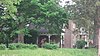 | January 13, 1992 (#91001909) | U.S. Route 231 ½ mile south of its junction with 500 North Rd. and north of Brick Chapel 39°43′36″N 86°52′04″W / 39.7267°N 86.8678°W / 39.7267; -86.8678 (James Edington Montgomery O'Hair House) | Monroe Township | |
| 25 | Oakalla Covered Bridge | Upload image | May 21, 2024 (#100010374) | County Road 375 West over Big Walnut Creek. 39°37′35″N 86°55′01″W / 39.6264°N 86.9169°W / 39.6264; -86.9169 (Oakalla Covered Bridge) | Greencastle vicinity | |
| 26 | Old Greencastle Historic District |  | June 23, 2011 (#11000389) | Roughly bounded by W. Liberty, Market, W. Poplar, and W. Gillespie Sts. 39°38′44″N 86°52′03″W / 39.6456°N 86.8675°W / 39.6456; -86.8675 (Old Greencastle Historic District) | Greencastle | |
| 27 | Pine Bluff Covered Bridge |  | May 21, 2024 (#100010375) | County Road 900 North over Big Walnut Creek. 39°47′36″N 86°46′25″W / 39.7932°N 86.7737°W / 39.7932; -86.7737 (Pine Bluff Covered Bridge) | Bainbridge vicinity | |
| 28 | Putnam County Bridge No. 159 |  | March 12, 1999 (#99000302) | County Road 650W over Big Walnut Creek at Reelsville 39°33′17″N 86°57′51″W / 39.5547°N 86.9642°W / 39.5547; -86.9642 (Putnam County Bridge No. 159) | Washington Township | |
| 29 | Putnamville Presbyterian Church |  | March 1, 1984 (#84001242) | State Road 243 at Putnamville 39°34′25″N 86°51′54″W / 39.5736°N 86.865°W / 39.5736; -86.865 (Putnamville Presbyterian Church) | Warren Township | |
| 30 | Roachdale Historic District | Upload image | August 18, 2020 (#100003187) | Generally bounded by Washington, Main, Grove and 102 South to 506 North Indiana Sts. 39°51′00″N 86°47′58″W / 39.8499°N 86.7995°W / 39.8499; -86.7995 (Roachdale Historic District) | Roachdale | |
| 31 | Rolling Stone Covered Bridge | Upload image | May 21, 2024 (#100010376) | County Road 800 North over Big Walnut Creek. 39°46′29″N 86°47′03″W / 39.7747°N 86.7841°W / 39.7747; -86.7841 (Rolling Stone Covered Bridge) | Bainbridge vicinity | |
| 32 | Russellville Historic District | Upload image | March 14, 2019 (#100003508) | Roughly bounded by Jesse Ave., Fordice, High & McCaw Sts. 39°51′24″N 86°59′06″W / 39.8567°N 86.985°W / 39.8567; -86.985 (Russellville Historic District) | Russellville | |
| 33 | Lycurgus Stoner House |  | September 12, 1985 (#85002134) | Manhattan Rd., southwest of Greencastle 39°34′58″N 86°54′55″W / 39.5828°N 86.9153°W / 39.5828; -86.9153 (Lycurgus Stoner House) | Washington Township | |
| 34 | William C. Van Arsdel House |  | September 20, 1984 (#84001246) | 125 Wood St. 39°38′31″N 86°51′00″W / 39.6419°N 86.85°W / 39.6419; -86.85 (William C. Van Arsdel House) | Greencastle |
Former listing
| [3] | Name on the Register | Image | Date listed | Date removed | Location | City or town | Description |
|---|---|---|---|---|---|---|---|
| 1 | Appleyard |  | February 23, 1990 (#90000325) | August 18, 2014 | Southern side of State Road 240, east of Greencastle[6] 39°38′19″N 86°49′08″W / 39.6386°N 86.8189°W / 39.6386; -86.8189 (Appleyard) | Greencastle Township |
See also
Wikimedia Commons has media related to National Register of Historic Places in Putnam County, Indiana.
- List of National Historic Landmarks in Indiana
- National Register of Historic Places listings in Indiana
- Listings in neighboring counties: Clay, Hendricks, Montgomery, Morgan, Owen, Parke
- List of Indiana state historical markers in Putnam County
References
- ^ The latitude and longitude information provided in this table was derived originally from the National Register Information System, which has been found to be fairly accurate for about 99% of listings. Some locations in this table may have been corrected to current GPS standards.
- ^ National Park Service, United States Department of the Interior, "National Register of Historic Places: Weekly List Actions", retrieved May 31, 2024.
- ^ a b Numbers represent an alphabetical ordering by significant words. Various colorings, defined here, differentiate National Historic Landmarks and historic districts from other NRHP buildings, structures, sites or objects.
- ^ "National Register Information System". National Register of Historic Places. National Park Service. March 13, 2009.
- ^ The eight-digit number below each date is the number assigned to each location in the National Register Information System database, which can be viewed by clicking the number.
- ^ Location derived from Division of Historic Preservation and Archaeology. Putnam County Interim Report. Indianapolis: Indiana Department of Natural Resources, 1982-04, 39. The NRIS lists the site as "Address Restricted".
- v
- t
- e
- List of U.S. National Historic Landmarks by state:
- Alabama
- Alaska
- Arizona
- Arkansas
- California
- Colorado
- Connecticut
- Delaware
- Florida
- Georgia
- Hawaii
- Idaho
- Illinois
- Indiana
- Iowa
- Kansas
- Kentucky
- Louisiana
- Maine
- Maryland
- Massachusetts
- Michigan
- Minnesota
- Mississippi
- Missouri
- Montana
- Nebraska
- Nevada
- New Hampshire
- New Jersey
- New Mexico
- New York
- North Carolina
- North Dakota
- Ohio
- Oklahoma
- Oregon
- Pennsylvania
- Rhode Island
- South Carolina
- South Dakota
- Tennessee
- Texas
- Utah
- Vermont
- Virginia
- Washington
- West Virginia
- Wisconsin
- Wyoming
 National Register of Historic Places portal
 Category


