Molonou
Town and sub-prefecture in Lacs, Ivory Coast
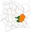
7°8′N 5°25′W / 7.133°N 5.417°W / 7.133; -5.417 Ivory Coast
 (2014)[1]
Molonou is a town in central Ivory Coast. It is a sub-prefecture of Tiébissou Department in Bélier Region, Lacs District. The town is on the east shore of Lake Kossou.
Molonou was a commune until March 2012, when it became one of 1126 communes nationwide that were abolished.[2]
In 2014, the population of the sub-prefecture of Molonou was 20,140.[3]
Villages
The 17 villages of the sub-prefecture of Molonou and their population in 2014 are:[3]
- Abé (759)
- Abrika (192)
- Aman-Salékro (4 585)
- Amanzi (591)
- Assuikro (1 413)
- Do-Sakassou (985)
- Grogro (868)
- Koffi Agrokro (1 134)
- Komorossou (1 240)
- Konan Kuikro (598)
- Konankro (997)
- Kondrobo (678)
- Molonou (2 709)
- N'dénou (758)
- Niamienkro (613)
- Ya-Dibikro (1 677)
- Yuakré (343)
References
- ^ "Côte d'Ivoire". geohive.com. Retrieved 9 December 2015.
- ^ "Le gouvernement ivoirien supprime 1126 communes, et maintient 197 pour renforcer sa politique de décentralisation en cours", news.abidjan.net, 7 March 2012.
- ^ a b "RGPH 2014, Répertoire des localités, Région Bélier" (PDF). ins.ci. Retrieved 5 August 2019.
- v
- t
- e
Departments and sub-prefectures of Bélier Region, Lacs DistrictRegional seat: Yamoussoukro
- Lomokankro
- Molonou
- Tiébissou*
- Yakpabo-Sakassou
* also a commune
 | This Lacs District location article is a stub. You can help Wikipedia by expanding it. |
- v
- t
- e


