Ilhéu Quixibá
0°04′24″N 6°35′10″E / 0.0733°N 6.5861°E / 0.0733; 6.5861Administration Demographics Population 0 Settlements 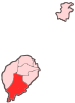
Geographical features Culture
Ilhéu Quixibá is an uninhabited islet in the Gulf of Guinea and is one of the smaller islands of São Tomé and Príncipe.[1] The islet lies 0.3 km off the southeast coast of the island of São Tomé.
References
- ^ Ilhéu Quixibá
- v
- t
- e
- Angra Toldo
- Dona Augusta
- Ilhéu das Rolas
- Monte Mário
- Ponta Baleia
- Porto Alegre
- Praia Pesqueira
- Ribeira Peixe
- Santa Josefina
- São João dos Angolares
- Vila Clotilde
- Vila Malanza

 São Tomé and Príncipe portal

- Canal das Rolas
- Parque Natural Obô de São Tomé
- Pico Cão Grande
- Ponta Baleia
- Praia Inhame
- Ilhéu Quixibá
- Ilhéu das Rolas
- Sete Pedras
 Islands of São Tomé and Príncipe Islands of São Tomé and Príncipe | |
|---|---|
| Major islands | |
| Minor islands and islets | |
 | This São Tomé and Príncipe geographical location article is a stub. You can help Wikipedia by expanding it. |
- v
- t
- e


