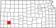
Haskell Township, Haskell County, Kansas
Township in Kansas, United States
37°34′00″N 100°52′22″W / 37.56667°N 100.87278°W / 37.56667; -100.87278 (2000)
Haskell Township is a township in Haskell County, Kansas, USA. As of the 2000 census, its population was 1,971.
Geography
Haskell Township covers an area of 192.5 square miles (499 km2) and contains one incorporated settlement, Sublette (the county seat). According to the USGS, it contains two cemeteries: Haskell and Ivanhoe.
Transportation
Haskell Township contains two airports or landing strips: Currey Farms Airport and Sublette Flying Club Land Strip.
References
- USGS Geographic Names Information System (GNIS)
External links
- US-Counties.com
- City-Data.com
- v
- t
- e
Municipalities and communities of Haskell County, Kansas, United States
County seat: Sublette
- Satanta
- Sublette
communities
- Tice
- Santa Fe
- Kansas portal
- United States portal
 | This article about a location in Haskell County, Kansas is a stub. You can help Wikipedia by expanding it. |
- v
- t
- e


