Cowanshannock Creek
River in the United States
40°49′34″N 79°10′32″W / 40.8261758°N 79.1755926°W / 40.8261758; -79.1755926 • coordinates
• elevation
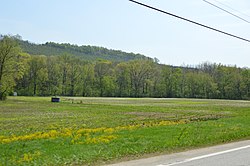
Cowanshannock Creek (the eastern section is sometimes referred to as the North Branch Cowanshannock Creek) is a tributary of the Allegheny River in Armstrong and Indiana counties, Pennsylvania in the United States.[1]
Course
Cowanshannock Creek rises in South Mahoning Township in Indiana County, Pennsylvania. It flows west into Armstrong County meandering through Cowanshannock Township, the borough of Rural Valley, Valley Township, Manor Township, and Rayburn Township. The stream joins the Allegheny River on its right bank at the community of Gosford, approximately 3 miles (4.8 km) northeast of Kittanning.
Tributaries
(Mouth at the Allegheny River)
- Craigs Run [2]
- Long Run [3]
- Mill Run [4]
- Spra Run [5]
- Huskins Run [6]
- South Branch Cowanshannock Creek [7]
- Spruce Run [8]
See also
- Tributaries of the Allegheny River
- List of rivers of Pennsylvania
- List of tributaries of the Allegheny River
References
- ^ "Cowanshannock Creek". Geographic Names Information System. United States Geological Survey, United States Department of the Interior. Retrieved 2010-11-15.
- ^ "Craigs Run". Geographic Names Information System. United States Geological Survey, United States Department of the Interior. Retrieved 2018-11-23.
- ^ "Long Run". Geographic Names Information System. United States Geological Survey, United States Department of the Interior. Retrieved 2018-11-23.
- ^ "Mill Run". Geographic Names Information System. United States Geological Survey, United States Department of the Interior. Retrieved 2010-11-18.
- ^ "Spra Run". Geographic Names Information System. United States Geological Survey, United States Department of the Interior. Retrieved 2010-11-18.
- ^ "Huskins Run". Geographic Names Information System. United States Geological Survey, United States Department of the Interior. Retrieved 2010-11-18.
- ^ "South Branch Cowanshannock Creek". Geographic Names Information System. United States Geological Survey, United States Department of the Interior. Retrieved 2010-11-18.
- ^ "Spruce Run". Geographic Names Information System. United States Geological Survey, United States Department of the Interior. Retrieved 2010-11-18.
External links
Map all coordinates using OpenStreetMap
Download coordinates as:
- KML
- GPX (all coordinates)
- GPX (primary coordinates)
- GPX (secondary coordinates)
- U.S. Geological Survey: PA stream gaging stations
- Cowanshannock Creek Watershed River Conservation Plan – DCNR
- Cowanshannock Creek Watershed Association


