Liste der Flughäfen und Flugplätze in Honduras
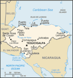
Die Liste der Flughäfen und Flugplätze in Honduras zeigt die Flughäfen und Flugplätze des mittelamerikanischen Staates Honduras, geordnet nach Orten.
Namen in Fettschrift zeigen regelmäßigen Linienverkehr an.
Flughäfen
| Ort | Department | ICAO-Code | IATA-Code | Name des Flughafens | Koordinaten |
|---|---|---|---|---|---|
| Ahuás | Gracias a Dios | MHAH | AHS | Ahuas Airport | 15° 28′ 20″ N, 84° 21′ 10″ W15.472222222222-84.352777777778 |
| Amapala | Valle | MHAM | Amapala Airport (Los Pelonas) (geschlossen) | 13° 17′ 2″ N, 87° 37′ 5″ W13.283888888889-87.618055555556 | |
| Brus Laguna | Gracias a Dios | MHBL | BHG | Brus Laguna Airport | 15° 45′ 45″ N, 84° 32′ 35″ W15.7625-84.543055555556 |
| Catacamas | Olancho | MHGE | El Aguacate Airport | 14° 52′ 30″ N, 85° 46′ 30″ W14.875-85.775 | |
| Cauquira | Gracias a Dios | MHCU | CDD | Cauquira Airport | 15° 19′ 15″ N, 83° 36′ 15″ W15.320833333333-83.604166666667 |
| Choluteca | Choluteca | MHCH | Choluteca Airport | 13° 19′ 10″ N, 87° 8′ 58″ W13.319444444444-87.149444444444 | |
| Comayagua | Comayagua | MHSC | XPL | Palmerola International Airport | 14° 22′ 57″ N, 87° 37′ 16″ W14.3825-87.621111111111 |
| Copán Ruinas | Copán | MHRU | RUY | Copán Ruinas Airport | 14° 55′ 0″ N, 89° 0′ 28″ W14.916666666667-89.007777777778 |
| Coyoles | Yoro | MHCS | CYL | Coyoles Airport | 15° 26′ 45″ N, 86° 40′ 30″ W15.445833333333-86.675 |
| El Porvenir | Colón | MHPV | El Porvenir Airport | 15° 31′ 50″ N, 86° 16′ 30″ W15.530555555556-86.275 | |
| Erandique | Lempira | MHGU | EDQ | Erandique Airport | 14° 14′ 10″ N, 88° 26′ 15″ W14.236111111111-88.4375 |
| Gracias | Lempira | MHGS | GAC | Celaque Airport | 14° 34′ 25″ N, 88° 35′ 45″ W14.573611111111-88.595833333333 |
| Gualaco | Olancho | MHJI | GUO | Jicalapa Airport | 15° 0′ 25″ N, 86° 3′ 0″ W15.006944444444-86.05 |
| Guanaja | Bay Islands | MHNJ | GJA | Guanaja Airport | 16° 26′ 43″ N, 85° 54′ 24″ W16.445277777778-85.906666666667 |
| Islas del Cisne (Swan Islands) | Bay Islands | MHIC | Islas del Cisne Airport | 17° 24′ 25″ N, 83° 56′ 0″ W17.406944444444-83.933333333333 | |
| La Ceiba | Atlántida | MHLC | LCE | Golosón International Airport | 15° 44′ 32″ N, 86° 51′ 10″ W15.742222222222-86.852777777778 |
| La Esperanza | Colón | MHEZ | La Esperanza Airport | 15° 36′ 35″ N, 86° 8′ 20″ W15.609722222222-86.138888888889 | |
| La Esperanza | Intibucá | MHLE | LEZ | La Esperanza Airport | 14° 17′ 25″ N, 88° 10′ 30″ W14.290277777778-88.175 |
| La Unión | Olancho | MHCR | LUI | La Unión Airport | 15° 2′ 0″ N, 86° 41′ 33″ W15.033333333333-86.6925 |
| La Lima | Cortés | LLH | La Lima Airport | 15° 26′ 35″ N, 87° 53′ 55″ W15.443055555556-87.898611111111 | |
| Marcala | La Paz | MHMA | MRJ | Departamento Marcala Airport – geschlossen | 14° 9′ 43″ N, 88° 2′ 4″ W14.161944444444-88.034444444444 |
| Mocorón | Gracias a Dios | MHDU | Mocorón Airport (Durzona) | 15° 1′ 46″ N, 84° 16′ 17″ W15.029444444444-84.271388888889 | |
| Nueva Ocotepeque | Ocotepeque | MHNV | Nueva Ocotepeque Airport | 14° 25′ 50″ N, 89° 11′ 40″ W14.430555555556-89.194444444444 | |
| Olanchito | Yoro | MHOA | OAN | El Arrayán Airport | 15° 30′ 25″ N, 86° 34′ 35″ W15.506944444444-86.576388888889 |
| Palacios | Gracias a Dios | MHPC | PCH | Palacios Airport | 15° 57′ 15″ N, 84° 56′ 25″ W15.954166666667-84.940277777778 |
| Puerto Castilla | Colón | MHCT | Puerto Castilla Airport – geschlossen | 16° 0′ 30″ N, 85° 58′ 5″ W16.008333333333-85.968055555556 | |
| Puerto Lempira | Gracias a Dios | MHPL | PEU | Puerto Lempira Airport | 15° 15′ 45″ N, 83° 46′ 55″ W15.2625-83.781944444444 |
| Roatán | Bay Islands | MHRO | RTB | Juan Manuel Gálvez International Airport | 16° 19′ 2″ N, 86° 31′ 2″ W16.317222222222-86.517222222222 |
| San Pedro Sula | Cortés | MHLM | SAP | Internationaler Flughafen Ramón Villeda Morales | 15° 27′ 10″ N, 87° 55′ 25″ W15.452777777778-87.923611111111 |
| Santa Bárbara | Santa Bárbara | MHSB ( | Santa Bárbara Airport (Honduras) – geschlossen | 14° 56′ 17″ N, 88° 14′ 29″ W14.938055555556-88.241388888889 | |
| Santa Rosa de Copán | Copán | MHSR | SDH | Santa Rosa de Copán Airport – geschlossen | 14° 46′ 38″ N, 88° 46′ 30″ W14.777222222222-88.775 |
| Tegucigalpa | Francisco Morazán | MHTG | TGU | Toncontín Airport | 14° 3′ 39″ N, 87° 13′ 2″ W14.060833333333-87.217222222222 |
| Tela | Atlántida | MHTE | TEA | Tela Airport | 15° 46′ 35″ N, 87° 28′ 30″ W15.776388888889-87.475 |
| Trujillo | Colón | MHTJ | TJI | Trujillo Airport | 15° 55′ 37″ N, 85° 56′ 18″ W15.926944444444-85.938333333333 |
| Victoria | Yoro | VTA | Victoria Airport | 14° 56′ 5″ N, 87° 23′ 39″ W14.934722222222-87.394166666667 | |
| Yoro | Yoro | MHYR | ORO | Yoro Airport | 15° 7′ 40″ N, 87° 8′ 8″ W15.127777777778-87.135555555556 |
| Útila | Bay Islands | MHUT | UII | Útila Airport | 16° 6′ 45″ N, 86° 52′ 50″ W16.1125-86.880555555556 |
Die folgenden Flugplätze haben nicht bestätigte Koordinaten:
| Ort | Department | ICAO | IATA | Flugplatz name |
|---|---|---|---|---|
| Comayagua | Comayagua | MHCG | Comayagua Airport | |
| El Progreso | Yoro | MHPE | El Progreso Airport | |
| Iriona | Colón | MHIR | IRN | Iriona Airport |
| Juticalpa | Olancho | MHJU | JUT | Juticalpa Airport |
| Limón | Colón | MHLN | LMH | Limón Airport |
| Puerto Cortés | Cortés | MHPU | Puerto Cortes Airport | |
| San Esteban | Colón | SET | San Esteban Airport | |
| Sulaco | Yoro | MHUL | SCD | Sulaco Airport |
| Tocoa | Colón | MHTO | TCF | Tocoa Airport |
Siehe auch
Weblinks
- IATA-Code-Suche
- Airport Code Database Search
- Great Circle Mapper. - IATA and ICAO codes
- Karte mit allen Koordinaten:
- OSM
- WikiMap

Flughäfen in Nord- und Mittelamerika nach Staat
Antigua und Barbuda | Bahamas | Belize | Costa Rica | Dominica | Dominikanische Republik | El Salvador | Grönland | Guatemala | Haiti | Honduras | Jamaika | Kanada | Kuba | Mexiko | Nicaragua | Panama | Vereinigte Staaten
Flughäfen nach Staat in:
Afrika | Asien | Australien und Ozeanien | Europa | Nordamerika | Südamerika


